The Derwent Valley
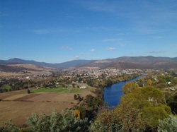
On the lower reaches of a great river, fast-flowing currents toss
hanging willow fronds and chatter over shingly rapids. Roadside poplars
blaze with autumn gold; vineyards and hop gardens grow a precious
harvest from deep alluvial soil. Westward in an historic national park,
the tallest flowering plants on Earth tower above the leaf litter.
Nearby, a much-photographed forest cascade tumbles over cliffs of
ancient rock, and a mountain road climbs through changing forests to
reach a world carved by ice. On the crest of the plateau, canals,
flumes and silver penstocks carry the pure mountain water that drives
hydro turbines – downstream, the same water fills the city’s drinking
glasses. Highland tarns glitter across a glaciated landscape, once clad
in ice hundreds of metres thick – alpine gardens form a natural harmony
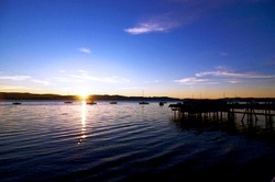
of rock, plants and water. The river’s source is a place of serenity and beauty –
a deep lake that the first Tasmanian's knew as Leeawuleena, ‘sleeping
water.’
River Stories
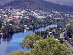
This is a journey along a river – the River Derwent – from where it
broadens into Hobart’s harbour, upstream to the source of the river in
lake St Clair. Originally the home of settlers from Norfolk Island, New
Norfolk is a town to explore on foot, with a self-guided walking tour,
taking in historic churches, parks and the Willow Court precinct. Close
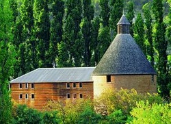
to town, the Oast House Hop Museum showcases one of the valley’s
longest-lasting industries; from the bridge, a jet boat skims
through quiet reaches and rushing rapids. On the Clyde River, a
tributary of the Derwent, the sleepy village of Hamilton was carefully
surveyed and planned as the capital of Van Diemen’s land. Today,
well-preserved Georgian cottages line the broad main street. Further on
is the rural town of Ouse – in the early days of the colony, this was
the end of the settled lands.
Energy From Flowing Waters
A line of silver towers marches into the high country from Ouse. you’re
following the route of the pioneers who built Tasmania’s hydro-electric
schemes, naming them with melodious Aboriginal names – Wayatinah,
liapootah, Tungatinah – and Tarraleah, where the old Hydro town has been
transformed into a warm and welcoming highland resort, an ideal base
for activities such as trout fishing, mountain biking, bushwalking and
canoeing. After a steep descent to the valley of the Nive and a winding
climb on the far side, the highway crosses the bleakly beautiful
Central Plateau, scoured to bare rock by glaciers. On the western
horizon rise the southern peaks of the Cradle Mountain-lake St Clair
National Park.
From Derwent Bridge, an essential detour to Cynthia Bay and lake St Clair takes you to the feet of those mountains. The lake where the River Derwent rises is surrounded by the lofty heights of Mt Rufus, Mt Olympus and Mt Ida. Australia’s highest-altitude ferry cruises to the head of the lake. Bushwalkers on the famous Overland Track use the ferry to save a day’s walk, but it’s also a wonderful return trip, cruising alongside magnificent myrtle forest and watching the mountains of the World Heritage Area come into view, summit by summit.
From Derwent Bridge, an essential detour to Cynthia Bay and lake St Clair takes you to the feet of those mountains. The lake where the River Derwent rises is surrounded by the lofty heights of Mt Rufus, Mt Olympus and Mt Ida. Australia’s highest-altitude ferry cruises to the head of the lake. Bushwalkers on the famous Overland Track use the ferry to save a day’s walk, but it’s also a wonderful return trip, cruising alongside magnificent myrtle forest and watching the mountains of the World Heritage Area come into view, summit by summit.
Left-Bank Wanderings
Stay left on the roundabout before the bridge at New Norfolk – the left
bank of the river takes you to the Salmon Ponds at Plenty, where the
first trout eggs brought to Tasmania were hatched.
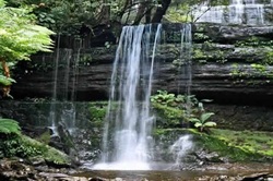
Groves of mature trees line the ponds where big trout swirl; the Museum of Trout Fishing tells the stories of angling in Tasmania. Further on are the hop-growing towns of Bushy Park and Glenora – the flowers of the region’s hop vines give flavour and fragrance to Australia’s favourite tipple. Branch left at Westerway to reach Mt Field National Park, one of the world’s earliest nature reserves. Tall forests tower over the easy stroll to the beautiful Russell Falls and the lake Dobson Road climbs towards the walking tracks that explore deep into the park.
Groves of mature trees line the ponds where big trout swirl; the Museum of Trout Fishing tells the stories of angling in Tasmania. Further on are the hop-growing towns of Bushy Park and Glenora – the flowers of the region’s hop vines give flavour and fragrance to Australia’s favourite tipple. Branch left at Westerway to reach Mt Field National Park, one of the world’s earliest nature reserves. Tall forests tower over the easy stroll to the beautiful Russell Falls and the lake Dobson Road climbs towards the walking tracks that explore deep into the park.
Village In The Wilderness
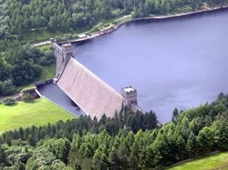
The Gordon Road begins in the timber town of Maydena, passing the giant
forests of the Styx and penetrating deep into the Southwest to reach
lake Pedder and Strathgordon. The workers who built the Gordon Power
Development Scheme lived here – today, the lake is a popular trout
fishing hot-spot. A short drive takes you to the edge of the steep and
dramatic curve of the mighty Gordon Dam.
A Wonder In Wood
Just before Derwent Bridge, an amazing experience awaits you – the Wall in the Wilderness.
This is a monumental artwork in progress by self-taught sculptor Greg Duncan, who is carving the heritage of the highlands in 100 panels of Huon pine, each three metres tall and a metre wide. Shaped by Greg’s chisels, draught horses and Tasmanian tigers come to life; muscles strain in the brawny arms of a miner; feathers ruffle in the expansive wings of a wedge-tail eagle.
This is a monumental artwork in progress by self-taught sculptor Greg Duncan, who is carving the heritage of the highlands in 100 panels of Huon pine, each three metres tall and a metre wide. Shaped by Greg’s chisels, draught horses and Tasmanian tigers come to life; muscles strain in the brawny arms of a miner; feathers ruffle in the expansive wings of a wedge-tail eagle.
A Chip, A Putt And A Dram Or Two
From Hamilton, a country road heads eastward, climbing to the crest of
the Central Plateau and the historic town of Bothwell, where Scottish
settlers carved grazing properties from the wild country. They were keen
golfers, too – on the property Ratho is Australia’s oldest golf course;
nearby are the fascinating displays in the Australasian Golf Museum.
You’ll feel the presence of the past when you stay in The Priory Country
lodge, a country mansion in the grand style. Nearby, cast for a wild
brown trout and taste The Nant Single Malt, distilled on one of the
original settlers’ estates.
Information with thanks from www.discovertasmania.com, and images from google images
